Difference between revisions of "Online Resources"
m |
(→Tools) |
||
| (15 intermediate revisions by one other user not shown) | |||
| Line 1: | Line 1: | ||
[[Category:Miscellany]] | [[Category:Miscellany]] | ||
| + | __TOC__ | ||
| + | |||
| + | =Websites= | ||
| + | A collection of websites devoted to the environment and the climate crisis: | ||
| + | |||
| + | [https://www.bbc.com/future/future-planet BBC Future Planet] | ||
| + | |||
| + | [https://www.vox.com/energy-and-environment Energy and the Environment] - VOX | ||
| + | |||
| + | [https://www.theguardian.com/us/environment The Guardian:Environment] | ||
| + | |||
| + | [https://www.joboneforhumanity.org/ Job One for Humanity] | ||
| + | |||
| + | [https://climate.nasa.gov/ "Global Climate Change, Vital Signs of the Planet"] - NASA | ||
| + | |||
| + | [https://www.noaa.gov/climate "Climate"] - NOAA | ||
| + | |||
| + | [https://www.climate.gov/ Climate.gov] - NOAA | ||
| + | |||
| + | [https://www.ncei.noaa.gov/ National Centers for Environmental Information] - NOAA | ||
| + | |||
| + | [https://www.nytimes.com/section/climate The New York Times:Climate and Environment] | ||
| + | |||
| + | [https://www.rewiringamerica.org/ Rewiring America ] | ||
| + | |||
=Tools= | =Tools= | ||
| + | The [https://open-power-system-data.org/ open power systems data platform] site contains data sets on power generation, load profiles and other similar resources. | ||
| + | |||
| + | |||
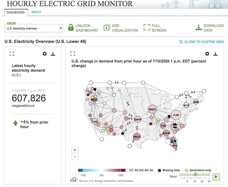
| + | [https://www.eia.gov/beta/electricity/gridmonitor/dashboard/electric_overview/US48/US48 EIA Hourly Dashboard of National and regional Energy Usage] | ||
| + | <br/><br/> | ||
| + | |||
| + | [[File:HourlyElectric.jpg|border|center|750px|border]] | ||
| + | |||
| + | <div style="text-align: center;">An example screen shot.</div> | ||
| + | |||
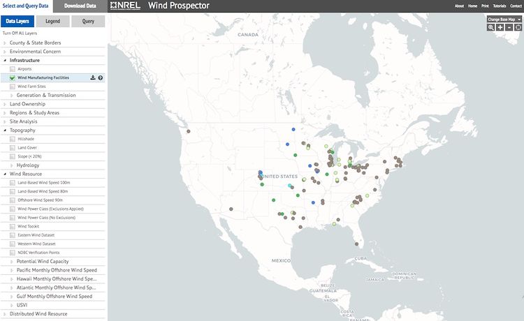
| + | The [https://www.nrel.gov/gis/wind.html National Renewable Energy Laboratory (NREL) GeoSpatial Data Sciences] offers many tools, charts and visualizations of data for biomass, geothermal, hydrogen, marine & hydrokinetic, solar and wind. For example see: | ||
| + | |||
| + | [https://maps.nrel.gov/wind-prospector/ Wind Prospector] | ||
| + | |||
| + | [[File:WindProspector.jpg|border|center|750px]] | ||
| + | |||
| + | <div style="text-align: center;">An example screen shot.</div> | ||
| + | |||
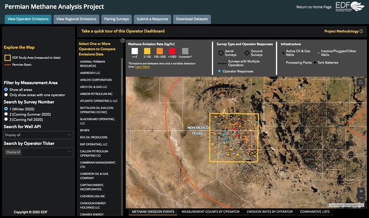
| + | The [https://data.permianmap.org/pages/operators Permian Methane Analysis Project] website offers has a rich collection of interactive maps where one can explore regional methane emissions by operator using surveys from 2020. | ||
| + | |||
| + | |||
| + | [[File:PMAP.jpg|center|750px]] | ||
| + | |||
| + | <div style="text-align: center;">An example screen shot.</div> | ||
| + | |||
| + | [[Permian Basin Methane Leaks]] are a problem for New Mexico and Texas. | ||
| + | |||
| + | =Tools In Development= | ||
| + | |||
| + | :[https://www.climatetrace.org/ Climate Trace] - Predicted to come in Summer 2021, the Climate TRACE coalition claims to be building a tool that will use artificial intelligence, satellite image processing, machine learning, and other remote sensing technologies to monitor worldwide greenhouse gas (GHG) emissions. The coalition aims to track human-caused emissions to specific sources in real time—independently and publicly. | ||
| + | |||
| + | =Wikis= | ||
| − | : [https:// | + | : [https://openei.org/wiki/Main_Page Open Energy Information] - Linked energy information on hundreds of topics crowdsourced from industry and government agencies. |
Latest revision as of 03:13, 11 January 2021
Contents
Websites
A collection of websites devoted to the environment and the climate crisis:
Energy and the Environment - VOX
"Global Climate Change, Vital Signs of the Planet" - NASA
"Climate" - NOAA
Climate.gov - NOAA
National Centers for Environmental Information - NOAA
The New York Times:Climate and Environment
Tools
The open power systems data platform site contains data sets on power generation, load profiles and other similar resources.
EIA Hourly Dashboard of National and regional Energy Usage
The National Renewable Energy Laboratory (NREL) GeoSpatial Data Sciences offers many tools, charts and visualizations of data for biomass, geothermal, hydrogen, marine & hydrokinetic, solar and wind. For example see:
The Permian Methane Analysis Project website offers has a rich collection of interactive maps where one can explore regional methane emissions by operator using surveys from 2020.
Permian Basin Methane Leaks are a problem for New Mexico and Texas.
Tools In Development
- Climate Trace - Predicted to come in Summer 2021, the Climate TRACE coalition claims to be building a tool that will use artificial intelligence, satellite image processing, machine learning, and other remote sensing technologies to monitor worldwide greenhouse gas (GHG) emissions. The coalition aims to track human-caused emissions to specific sources in real time—independently and publicly.
Wikis
- Open Energy Information - Linked energy information on hundreds of topics crowdsourced from industry and government agencies.


